Menu
County Neighbors
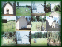
Church and Cemeteries...Church's and Cemeteries of Carroll County, Mississippi |
|
|
|
|
Herring Cemetery(Note: These directions are provided by Jim Norris, to the Grantham Cemetery close by. Refer to additional directions at the bottom of this page to locate the Herring Cemetery) Location: I found the cemetery(Grantham) listed under Montgomery county, as it is associated with the Pine Bluff Baptist Church area. From Winona ate 407 east approximately 10 miles. Take a right on Seymore road and stay on Seymore for about 3 miles until you reach Pine Bluff Baptist Church. Take a right on Ferguson Road (may not be marked as such). Stay to the left, approximately 1/2 mile there will be a fork, but stay left. Continue on the road, as it becomes Carroll County Rd 6 and then take a Left , at the T junction of County Road 8. Go down this road, and look for a house on the right, a white farm house, nicely kept, the E.L. Pullens house. Stop the car in front of the house on the right. To the left is a wooded hill. There is a path, alongside the pasture adjacent to the wooded hill. Go up the path and you will go into a wooded area. Walk about 5-10 minutes. Look to the left, about 50 feet or so from the path, you might notice some gravestones, but you will have to look hard. Walk off the path, and you will notice a barbed wire fence surrounding the old graveyard. As you might imagine, it has become overgrown in woods. The cemetery appears to date from after the civil war up until the early 1900's. Surnames on gravestones include Mathews, Ferguson, Garner among others. Many surnames listed on the Census of 1870, (township 17, range 6, page 259) are same as in this cemetery. There are unmarked graves, including a small section surrounded by an wrought iron fence, with no markings inside. Also, the Pine Bluff Cemetery at Pine Bluff Baptist church had similar surnames. I surmise it was it's predecessor in that community. I hope this information is helpful to someone. Thanks Jim Norris ADDITIONAL DIRECTIONS TO HERRING CEMETERY: After looking at the Topo map and a satallite image on Terra Server I They (Grantham and
Herring) are in heavy woods off to the side of an old wagon road bed. I
looked over my notes and in them I had written that only W. D. Herring had
a marker the rest were field stones with initials carved into them. I was
told at the time that Bry Herring had carved the field stone markers. If
those markers are still there I'll get the initials, they might help
someone.
|
|
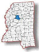
Carroll County
Coordinator:
I am
John Hansen,
volunteer County Coordinator for Carroll County, Mississippi. I have
family lines from here and hence my interest in establishing as much
information as possible on early Carroll County History.
Web Site:
The
Carroll County, Mississippi Genealogical and Historical Web Site was brought
online in 1998, and is sponsored by the
MSGenWeb Project,
a part of the
USGenWeb Project.
This website has been developed to provide research and family history
resources for Carroll County, Mississippi ancestry.
New resources are added as made available, so check back often for new
content.