Early History and
Settlement -
According to tradition, the ancient inhabitants of Mississippi
were the Alabama and Muscogee Indians, fleeing from Cortez in Mexico. They
had hardly become accustomed to the land of their exile when De Soto's army of
hidalgos, men-at-arms and monks entered their territory, and wintered in
Pontotoc County. After suffering the loss of 50 soldiers in a night
attack by the Chickasaws, De Soto stormed the Indian town of Alibamo, on the
Tallahatchie River, at the close of a hot and murderous battle. Even
after the Spanish army had turned southward from Arkansas, to retreat by boats
to the Gulf, the gallant Mississippians attacked their flotilla all along the
river, in fleets of canoes, and inflicted serious losses upon them.
More than
a century passed before Marquette and Joliet (in 1673) visited these shores,
passing from Quebec up to the Great Lakes, and descended the Wisconsin and
Mississippi. They were kindly received by the Chickasaws, and abode with
them many days. Nine years later La Salle followed the same route, and
visited the Natchez Indians, taking possession of the country in the name of
France; and not long afterward a brave priest established a Catholic
mission among the Tunicas. In 1669, an expedition sent out by Louis XIV
composed of 200 French-Canadians, and headed by Iberville and Bienville,
occupied Ship and Cat Islands, and erected a fort at Biloxi. Later, they
laid out the town of Rosalie, on the side of the Natchez. A settlement
arose here in 1716; and 13 years afterward the Indians massacred 200 of
its citizens, and carried 500 into captivity. French and Choctaw armies
marched against the Natchez tribe, and in a serious of arduous campaigns
entirely destroyed it, killing the bravest warriors, and sending hundreds of
others to San Domingo, as slaves. The Chickasaws dwelt in northern
Mississippi, and repulsed two campaigns of Bienville. In 1736 he led 550
French and Swiss soldiers and 600 Choctaws in boats up the Tombigbee River, to
Cotton-Gin Port, and marched against Ackia, where the Chickasaws defeated the
allies with terrible loss. At the same time D'Artaguette and 130 French
soldiers, and many Miami and Iroquois Indians, advanced from Illinois to
Chickasaw Bluffs and Pontotoc, and there suffered defeat at the hands of the
Chickasaws, the commander, with his priest and 16 other officers and soldiers,
being burned at the stake. In 1752 the Marquis de Vaudreuil was beaten by the
same indomitable tribe, and threw his artillery into the river at Cotton-Gin
Port, where cannon have since been found.
Most of
Mississippi was included in the vast cession of territory made by France to
England by the Treaty of Paris, in 1763, and belonged to the Province of
Illinois. The British province of West Florida at first included the region
south of 31 degrees; and afterwards the region south of the latitude of the
mouth of the Yazoo. Willing's American detachment 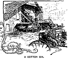 suffered
a repulse at Natchez in 1778, and the Tory inhabitants rebuilt old Fort Panmure,
and held it for England. In 1779 Don Bernardo de Galvez captured Natchez, at the
head of a force of Spanish infantry and American volunteers. After the
Spaniards had held Mississippi for three years, Aliton, Lyman, Phelps and other
New-England and Carolinian immigrants and royalists bombarded and captured
Natchez and then, assailed by the Spaniards, retreated to Savannah in a
five-months' march across the country, suffering terrible losses and hard-ships.
When West Florida was confirmed to Spain by treaty, and the United States
occupied the eastern side of the Mississippi Valley down thus far, the two
powers debated for years as to whether their frontiers lay at 31 degrees, or the
Yazoo. Spain yielded, in 1798, and Congress formed the disputed
territory, extending from the Mississippi to the Chattahoochee, into the
Mississippi Territory. In 1800 the present State lay in several jurisdictions;
from the Gulf to 31 degrees, in Spanish Louisiana; from 31 degrees to the
parallel of the Yazoo, in Mississippi Territory; and from the Yazoo northward
nearly to Tennessee, in Georgia. Congress bought out the claims of Georgia
in the West in 1802, and added the domain to the South-Carolina cession naming
the whole the Territory South of the River Ohio, and in 1804 adding it to
Mississippi Territory.
suffered
a repulse at Natchez in 1778, and the Tory inhabitants rebuilt old Fort Panmure,
and held it for England. In 1779 Don Bernardo de Galvez captured Natchez, at the
head of a force of Spanish infantry and American volunteers. After the
Spaniards had held Mississippi for three years, Aliton, Lyman, Phelps and other
New-England and Carolinian immigrants and royalists bombarded and captured
Natchez and then, assailed by the Spaniards, retreated to Savannah in a
five-months' march across the country, suffering terrible losses and hard-ships.
When West Florida was confirmed to Spain by treaty, and the United States
occupied the eastern side of the Mississippi Valley down thus far, the two
powers debated for years as to whether their frontiers lay at 31 degrees, or the
Yazoo. Spain yielded, in 1798, and Congress formed the disputed
territory, extending from the Mississippi to the Chattahoochee, into the
Mississippi Territory. In 1800 the present State lay in several jurisdictions;
from the Gulf to 31 degrees, in Spanish Louisiana; from 31 degrees to the
parallel of the Yazoo, in Mississippi Territory; and from the Yazoo northward
nearly to Tennessee, in Georgia. Congress bought out the claims of Georgia
in the West in 1802, and added the domain to the South-Carolina cession naming
the whole the Territory South of the River Ohio, and in 1804 adding it to
Mississippi Territory.
The region
south of 31 degrees was annexed to the United States by the Louisiana
Purchase. In 1812 this coast-strip became a part of Mississippi Territory,
which included also Alabama. The latter was set apart five years later,
leaving Mississippi with her present boundaries.
The
Choctaws of the south and the Chickasaws of the north were deported across the
Mississippi River in 1832-4, and then a great influx of immigration occupied
their deserted fields.
Civil War Era -
Mississippi was one of the first States to attempt secession, and as early as
January, 1861, planted artillery at Vicksburg to command the river. Late
in 1861 United States naval expeditions captured Biloxi and Ship Island. In 1862
Beauregard's Confederates yielded Corinth to Halleck's National troops, after a
long siege; and in October Gens. Price and Van Dorn assailed the town with
35,000 Confederates, and were terribly defeated by Rosecrans, sacrificing 9,000
men. At Iuka the two armies lost 1,000 men each. Vicksburg, on its high bluffs,
was the key of the Mississippi, and bristled with fortifications and cannon, 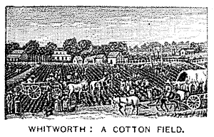 which
foiled Farragut, in June, and Sherman in December, 1862. In April, 1863, Grant
crossed the river at Bruinsburg; captured Grand Gulf and Jackson; defeated
Pemberton's 25,000 troops at Champion Hills; and on July 4th received the
surrender of Vicksburg, with 27,000 soldiers. In this campaign, which
practically ended the war in Mississippi, Grant lost 5,000 men, and the
Confederates lost 9,000. In 1865 Mississippi repealed the ordinance of
secession, and abolished slavery. It adopted a new constitution in 1869;
and in 1870, having ratified the 14th and 15th Amendments, its representatives
were admitted to Congress. The property valuation was lowered between 1860 and
1870, by the war and the liberation of the slaves, from $607,324,911 to
$209,197,345. It adopted a new constitution on November 1 1890.
which
foiled Farragut, in June, and Sherman in December, 1862. In April, 1863, Grant
crossed the river at Bruinsburg; captured Grand Gulf and Jackson; defeated
Pemberton's 25,000 troops at Champion Hills; and on July 4th received the
surrender of Vicksburg, with 27,000 soldiers. In this campaign, which
practically ended the war in Mississippi, Grant lost 5,000 men, and the
Confederates lost 9,000. In 1865 Mississippi repealed the ordinance of
secession, and abolished slavery. It adopted a new constitution in 1869;
and in 1870, having ratified the 14th and 15th Amendments, its representatives
were admitted to Congress. The property valuation was lowered between 1860 and
1870, by the war and the liberation of the slaves, from $607,324,911 to
$209,197,345. It adopted a new constitution on November 1 1890.
State Name -
The Name of
the State signifies “Great River.” It is an Algonquin compound word, originally
spelled Meche' Sebe' changed by the Chevalier Tonty to Miche'
Sepe' by Pere Laval to Michisepe by Pere Labatt to Misisipi and by
Mar-quette to Mississippi. The popular names of Mississippi are The Bayou
State, and The Border-Eagle State. The Arms of Mississippi bear an
American eagle, with outspread wings, holding arrows in one talon and an olive
branch in the other, on a round silver field.
List of Governors
- The Governors of Mississippi have been:
Territorial:
Winthrop Sargent, 1798—1801
Wm. C. C. Claiborne, 1805-5
Robert Williams, 1805—9
David Holmes, 1809—17
State:
David Holmes, 1817—19, and 1825—7
Geo. Poindexter, 1819—21
Walter Leake, 1822—5
Gerard C. Brandon, 1827—31
Abram M. Scott, 1832—3
Hiram G. Runnels, 1834—5
Chas. Lynch, 1835—7
Alex. G. McNutt, 1838—41
Tilghman M. Tucker, 1842—3
Albert G. Brown, 1844—8
Jos. W. Matthews, 1848—49
John A. Quitman, 1850-1
John I. Guion (acting), 1851
Jas. Whitefield (acting), 1851—2
Henry S. Foote, 1852—4
John J. McRae, 1854—7
Wm. McWillie, 1858—9
John J. Pettus, 1860—3
Chas. Clarke, 1864—5
Wm. L. Sharkey (appointed), 1865—6
Benj. G. Humphreys, 1866—70
Adelbert Ames (appointed), 1868—70
Jas. I. Alcorn, 1870
R. C. Powers (acting), 1870—4
Adelbert Ames, 1874—6
John Marshall Stone (acting), 1876—7
John M. Stone, 1878—81
Robert Lowry, 1882—9
John M. Stone, 1890—2
 Topical
Description -
The Mississippi lowlands cover 7,460 square miles, and the
remaining five sixths of the State are divided between rolling and level
uplands, with smooth prairies in the northeast. The streams descend gradually,
and their valleys are bordered by hum-mocks or second bottoms, while in their
lower reaches they often flood the country for miles. The elevation of the
uplands varies from 150 to 500 feet, and they fall away very gradually to the
south and southwest. The extreme south contains extensive marshes and
immeasurable penuries. The Yazoo Delta, a great ellipsoid, 160 miles long, is
one of the most fertile districts in the vast valley of the Mississippi. It lies
between Vicksburg and Tennessee, covering 6,250 square miles, with swamps and
lakes, bayous and prairies and great woods. The cultivated lands lie on the low
ridges and along the lakes and rivers, the rest being cane-brakes and cypress
swamps. The Delta would lie deep under water every spring but for the levees,
protecting part of these wonderfully fertile lands. The two levee districts have
efficient boards of commissioners to build and guard the levees, raising the
funds by a tax on each bale of cotton. The gray and white clays of the
northeast and the region of long-leaf pine are unproductive; but the rest of
Mississippi is of remarkable fertility, and half of it remains unused.
Topical
Description -
The Mississippi lowlands cover 7,460 square miles, and the
remaining five sixths of the State are divided between rolling and level
uplands, with smooth prairies in the northeast. The streams descend gradually,
and their valleys are bordered by hum-mocks or second bottoms, while in their
lower reaches they often flood the country for miles. The elevation of the
uplands varies from 150 to 500 feet, and they fall away very gradually to the
south and southwest. The extreme south contains extensive marshes and
immeasurable penuries. The Yazoo Delta, a great ellipsoid, 160 miles long, is
one of the most fertile districts in the vast valley of the Mississippi. It lies
between Vicksburg and Tennessee, covering 6,250 square miles, with swamps and
lakes, bayous and prairies and great woods. The cultivated lands lie on the low
ridges and along the lakes and rivers, the rest being cane-brakes and cypress
swamps. The Delta would lie deep under water every spring but for the levees,
protecting part of these wonderfully fertile lands. The two levee districts have
efficient boards of commissioners to build and guard the levees, raising the
funds by a tax on each bale of cotton. The gray and white clays of the
northeast and the region of long-leaf pine are unproductive; but the rest of
Mississippi is of remarkable fertility, and half of it remains unused.
Gulf Coast Region
-
The 90 miles of Mississippi coast lies on the Gulf of Mexico, whose waves beat
along a range of low islands from ten to 30 miles off-shore. Five
light-houses rise from these lonely sand-bars. Ship Island is a low bank
of white sand, seven miles long, with groves at its eastern end, and on the west
the best harbor of the Mississippi coast. This was the headquarters of the
West-Gulf Blockading Squadron and of Gen. Bader’s army, before the capture of
Pensacola and New Orleans. Inside the islands lies the placid Mississippi Sound,
in places deep enough for large ships, and bordered by low bluffs of shining
white sand. The shallow harbors of Mississippi City, Biloxi and Bay St. Louis
are mainly occupied by summer-resorts, among the water-oaks and live-oaks,
magnolias and cedars, with the solemn pines on one side and the opalescent
waters of the Sound on the other. Pass Christian is a favorite
pleasure-resort, with a fine hotel, two hours from New Orleans and three hours
from Mobile. Ancient Biloxi rambles over a sea-fronting line of
sand-hills, with shell-roads leading inland; and is a happy haven for sufferers
from consumption and asthma. In the summer great excursion-parties from
New Orleans crowd its hotels and restaurants, 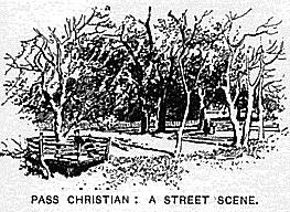 and
go fishing among the shadowy islands off-shore. The oysters and oranges of
Biloxi are equally celebrated for their flavors, and the place has canneries for
oysters and shrimp. The waters out-side abound in red-fish, black-fish, red
snappers, pom-pano, Spanish mackerel, sheepshead, trout, and other food-fish.
Ocean Springs, half a mile from the sea-beach, is a resort much visited by the
people of New Orleans and Mobile, who can enjoy in the same hour fine salt-water
bathing and the medicinal virtues of saline-chalybeate waters. Mississippi also
has several popular inland pleasure-resorts. Cooper’s Well is one of the 30
chief American springs described in the Encyclopedia Briticianna, where it ranks
as an iron water, beneficial for dyspepsia, dropsy, anaemia and other diseases.
Castalian Springs pours out red sulphur waters, strongly charged with
carbonic-acid gas and suiphuretted hydrogen. Brown’s Wells, in Copiah County,
are noted for their curative properties.
and
go fishing among the shadowy islands off-shore. The oysters and oranges of
Biloxi are equally celebrated for their flavors, and the place has canneries for
oysters and shrimp. The waters out-side abound in red-fish, black-fish, red
snappers, pom-pano, Spanish mackerel, sheepshead, trout, and other food-fish.
Ocean Springs, half a mile from the sea-beach, is a resort much visited by the
people of New Orleans and Mobile, who can enjoy in the same hour fine salt-water
bathing and the medicinal virtues of saline-chalybeate waters. Mississippi also
has several popular inland pleasure-resorts. Cooper’s Well is one of the 30
chief American springs described in the Encyclopedia Briticianna, where it ranks
as an iron water, beneficial for dyspepsia, dropsy, anaemia and other diseases.
Castalian Springs pours out red sulphur waters, strongly charged with
carbonic-acid gas and suiphuretted hydrogen. Brown’s Wells, in Copiah County,
are noted for their curative properties.
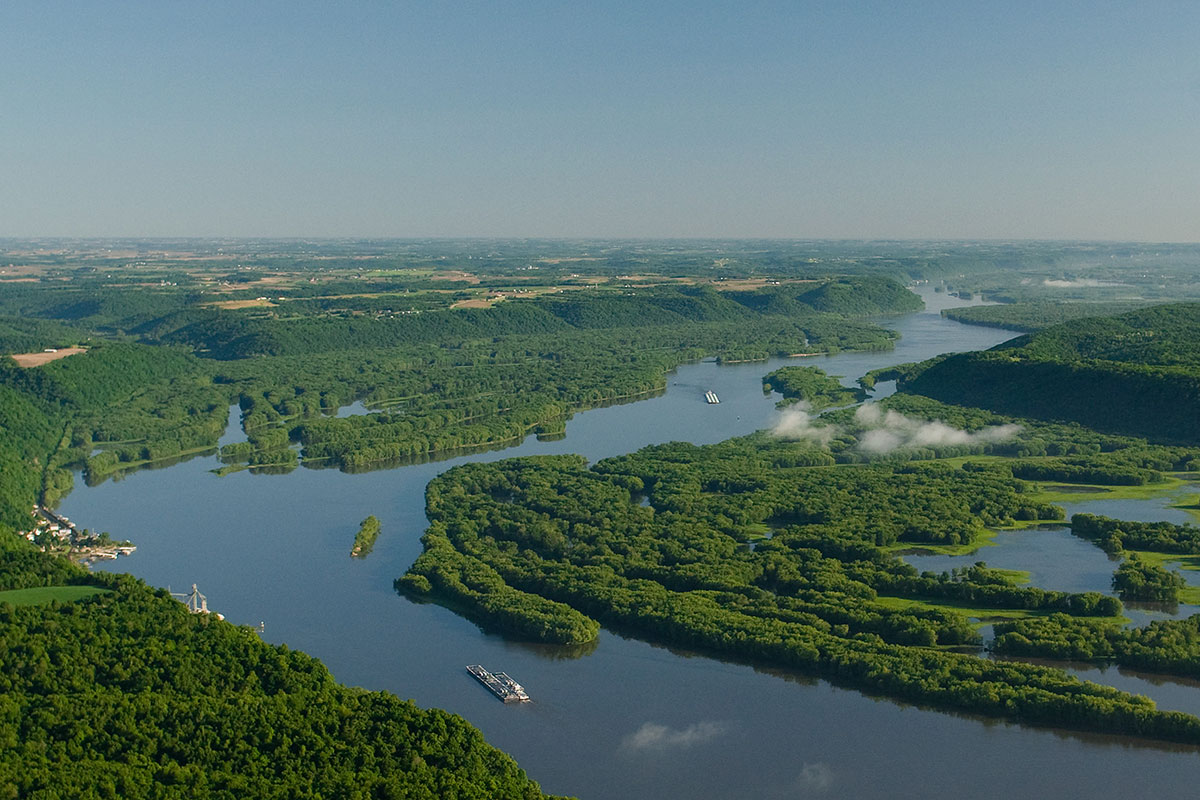
The Rivers
-
The Mississippi River flows along the western frontier, held in its channel by
immense and costly levees. The Tennessee River forms the northwestern
frontier for ten miles. The chief affluent of the Mississippi from this State is
the Yazoo River, formed by the confluence of the Yalobusba and
Tallahatchie, and flowing 264 miles southwest to the great river, seven miles
above Vicksburg. It is navigable throughout, and has a fleet of ten  steamboats,
with a yearly commerce of $3,500,000, including over 50,000 bales of cotton.
The Tallahatchie has a yearly commerce of $1, 500,000 in cotton, supporting nine
steam-boats, running up 500 miles to Sharkey’s Landing, and sometimes to
Coldwater, 165 miles. The Yalobusha has been ascended by steamboats to Grenada.
Tchula Lake is a bayou of the Yazoo, 60 miles long, and sending out yearly
14,000 bales of cotton on its four steam-boats. The Big Black River, 400 miles
long, enters the Mississippi at Grand Gulf. The Pearl River has had several
Government parties at work for many years, from its mouth to Jackson (310 miles)
and Edinburgh (440 miles), and the yearly commerce now amounts to $1,600,000
employing eleven steamboats. The Tombigbee River flows off into Alabama, the
head of winter-navigation being at Aberdeen, and at favorable seasons steamboats
may reach Fulton. Steamers ascend the Noxubee to Macon, 911/2
miles. The Pascagoula River is navigable 85 miles to the confluence of the Leaf
and the Chicasaha, for light vessels.
steamboats,
with a yearly commerce of $3,500,000, including over 50,000 bales of cotton.
The Tallahatchie has a yearly commerce of $1, 500,000 in cotton, supporting nine
steam-boats, running up 500 miles to Sharkey’s Landing, and sometimes to
Coldwater, 165 miles. The Yalobusha has been ascended by steamboats to Grenada.
Tchula Lake is a bayou of the Yazoo, 60 miles long, and sending out yearly
14,000 bales of cotton on its four steam-boats. The Big Black River, 400 miles
long, enters the Mississippi at Grand Gulf. The Pearl River has had several
Government parties at work for many years, from its mouth to Jackson (310 miles)
and Edinburgh (440 miles), and the yearly commerce now amounts to $1,600,000
employing eleven steamboats. The Tombigbee River flows off into Alabama, the
head of winter-navigation being at Aberdeen, and at favorable seasons steamboats
may reach Fulton. Steamers ascend the Noxubee to Macon, 911/2
miles. The Pascagoula River is navigable 85 miles to the confluence of the Leaf
and the Chicasaha, for light vessels.
Geology
- The Geology of
Mississippi shows a small sub-carboniferous district -in the northeast,
succeeded by Cretaceous formations. Half of the State is Tertiary, lying
between The Cretaceous and the Mississippi bottoms, and to within 20 miles of
the Gulf. Although contiguous to the rich metalliferous States of Alabama
and Tennessee, Mississippi has no mines, and her limestones and sandstones,
marls and fire-clays, have but little economic value.
Climate
-
The Climate is
almost sub-tropical, especially along the Gulf, where the freezing-point is
rarely reached. The summer season extends from May 1st to October 1st,  with
the thermometer from 60o to 95o (with a mean of 81o); but the heat is
tempered by variable winds, especially those from the Gulf. The mean
annual temperature of the Gulf towns is 68o; of Vicksburg, 65o; of
the north, 61o. The rainfall varies from 65 inches on the seaboard to 60
inches in the north, and mostly occurs in winter and spring. The
death-rate, 13 yearly in 1,000 is less than those of New York, Massachusetts,
Virginia, and Pennsylvania. The mortality of the whites is only 10 in
5,000. Lung and throat diseases and catarrh never originate here, and are
relieved when brought hither. Diphtheria is almost unknown; and the yellow
fever has not entered the State since 1878.
with
the thermometer from 60o to 95o (with a mean of 81o); but the heat is
tempered by variable winds, especially those from the Gulf. The mean
annual temperature of the Gulf towns is 68o; of Vicksburg, 65o; of
the north, 61o. The rainfall varies from 65 inches on the seaboard to 60
inches in the north, and mostly occurs in winter and spring. The
death-rate, 13 yearly in 1,000 is less than those of New York, Massachusetts,
Virginia, and Pennsylvania. The mortality of the whites is only 10 in
5,000. Lung and throat diseases and catarrh never originate here, and are
relieved when brought hither. Diphtheria is almost unknown; and the yellow
fever has not entered the State since 1878.
Agriculture and
Forestry
- Agriculture is pre-eminently the industry
of Mississippi, whose responsive soil and stimulating climate yield a great
profusion and variety of the fruits of the earth. More than four fifths of the
working population are in farming pursuits. The great plantations have given way
to small farms, the 43,000 estates enumerated in 1860 having become 125,000 in
1890. There are 1,000,000 acres of Government land, mostly in the long-leaf-pine
region towards the Gulf; and the railways also have large tracts for sale, at
low prices.
The cotton
crop of 1860 reached 1,200,000 bales, but the next five battle-years caused the
product to fall off greatly. By 1880 it had reached 960,000 bales, worth
$43,000,000, and the State stood foremost of all in this product. It is now
second to Texas. One third of this great wealth-making crop is produced by white
men’s labor, mainly in the upland counties, 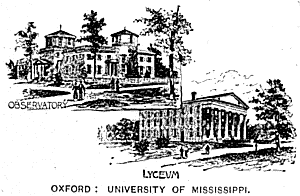 where
the climate is salubrious; and the rest by negroes, mainly in the Delta;
28,000,000 bushels of cotton-seed are harvested each year. The corn-crop
is about 25,000,000 bushels. Mississippi also yields yearly 3,500,000
bushels of oats, 2,000,000 of rice, 700,000 of potatoes, and 500,000 of wheat.
Figs, oranges, and Scuppernong grapes grow along the Gulf Coast;
blackberries overrun the wild lands everywhere; and strawberries and
melons and other fruits and vegetables are sent to the cities. Over 1,200
car-loads have been shipped North on one railway, in a single season. The
planters long waged war on “General
where
the climate is salubrious; and the rest by negroes, mainly in the Delta;
28,000,000 bushels of cotton-seed are harvested each year. The corn-crop
is about 25,000,000 bushels. Mississippi also yields yearly 3,500,000
bushels of oats, 2,000,000 of rice, 700,000 of potatoes, and 500,000 of wheat.
Figs, oranges, and Scuppernong grapes grow along the Gulf Coast;
blackberries overrun the wild lands everywhere; and strawberries and
melons and other fruits and vegetables are sent to the cities. Over 1,200
car-loads have been shipped North on one railway, in a single season. The
planters long waged war on “General
Green,” as they called the grasses; but the un-profitableness of
exclusive cotton-culture has turned their attention to pasturage. The
valuable Bermuda grass yields five tons of hay to the acre; Japan clover
has spread over the State with marvelous rapidity; and crab-grass and
broom-sedge also afford very good forage. The yearly hay-crop is 60,000
tons. The live stock includes 104,000 mules, 99,000 horses, 1,636,000
hogs, 440,000 cattle, and 200,000 sheep. Here are the largest dairying
interests in the Gulf States; and many herds of valuable Jersey Short-Horn
and Holstein cattle.
Forests
cover three fifths of Mississippi, and include oak, red cedar, black walnut,
poplar, cottonwood, tupelo and other trees. The long-leafed yellow-pine
fills most of the country south of the Meridian-Vicksburg line. The
pine-woods alone are valued at $250,000,000. The cypress and cane of the
swamps; the chestnut and walnut, beech and hickory of the bluffs; the red
gum of the Yazoo; all have an economic value.
Government
-
The
governor and six executive officers are elected for four years. The legislature
of 45 four-years’ senators and 133 four-years’ representatives, includes a
number of colored members. The three Supreme-Court justices, nine circuit judges
and twelve chancellors are appointed by the governor. No atheist may hold
office. The State House is a dignified old classic building, with a fine
portico. The militia, or National Guard, includes three regiments and two
battalions of infantry and several light batteries, armed by 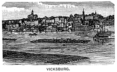 the
National Government. The valuation of the State increased 50 per cent,
between 1880 and 1890. The State Lunatic Asylum, the Institute for the
Deaf and Dumb, the Institute for the Blind, and the Penitentiary are all at
Jackson. The East-Mississippi Insane Asylum is at Meridian. The hospitals
at Vicksburg and Natchez receive subsidies from the State. The
Penitentiary is kept only for sick or aged or life-time convicts, the others
being leased to outside contractors. A Board of Control, consisting of the
three railroad commissioners, the Governor and Attorney-General, manage the
Penitentiary, and lessees are held to strict account for the humane treatment of
the convicts. After 1894, the leasing system will be abolished.
the
National Government. The valuation of the State increased 50 per cent,
between 1880 and 1890. The State Lunatic Asylum, the Institute for the
Deaf and Dumb, the Institute for the Blind, and the Penitentiary are all at
Jackson. The East-Mississippi Insane Asylum is at Meridian. The hospitals
at Vicksburg and Natchez receive subsidies from the State. The
Penitentiary is kept only for sick or aged or life-time convicts, the others
being leased to outside contractors. A Board of Control, consisting of the
three railroad commissioners, the Governor and Attorney-General, manage the
Penitentiary, and lessees are held to strict account for the humane treatment of
the convicts. After 1894, the leasing system will be abolished.
Education
- Education
is free to all children between five and 21, and is supervised by a State Board
and appointed county superintendents and elected boards of trustees. The
State normal schools are at Holly Springs, and Tougaloo for colored students;
and there are private normal schools. The University of Mississippi,
chartered in 1844 has 250 students, a library of 52,000 volumes (in a handsome
new Elizabethan building), and an endowment exceeding $500,000 on which the
State pays interest. There are undergraduate courses in 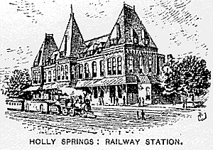 art,
science and philosophy; post-graduate courses; and a law school. The
University is near Oxford, and has three dormitories, an observatory, gymnasium,
and other buildings, with a domain of 640 acres. Students (even of other
States) receive tuition free, the expenses of the University being met by the
State. The Agricultural and Mechanical College, for white boys, supported
also by the State, and on the military system, is at Starkville; and with
it is connected the United States Experimental Station; about 350 students. The
Alcorn Agricultural and Mechanical College, in the southwest, has 240 colored
students. The Industrial Institute and College for the Education of White
Girls of Mississippi was opened at Columbus, in 1885 and has upwards of 300
students in the usual branches, besides drawing and wood-carving, stenography
and type-writing, book-keeping and telegraphy, printing and dress-making.
The State supports the college and gives free tuition to 300 students. All
the girls are uniformed in navy-blue dresses, sailor-hats and tan gloves.
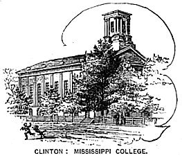
Mississippi College, founded in 1830, at Clinton, is a Baptist institution.
The colored people send their young men and women to Alcorn College, to Rust
University at Holly Springs, and to the normal schools at Holly Springs,
Tougaloo and Jackson, and the Meridian Academy.
art,
science and philosophy; post-graduate courses; and a law school. The
University is near Oxford, and has three dormitories, an observatory, gymnasium,
and other buildings, with a domain of 640 acres. Students (even of other
States) receive tuition free, the expenses of the University being met by the
State. The Agricultural and Mechanical College, for white boys, supported
also by the State, and on the military system, is at Starkville; and with
it is connected the United States Experimental Station; about 350 students. The
Alcorn Agricultural and Mechanical College, in the southwest, has 240 colored
students. The Industrial Institute and College for the Education of White
Girls of Mississippi was opened at Columbus, in 1885 and has upwards of 300
students in the usual branches, besides drawing and wood-carving, stenography
and type-writing, book-keeping and telegraphy, printing and dress-making.
The State supports the college and gives free tuition to 300 students. All
the girls are uniformed in navy-blue dresses, sailor-hats and tan gloves.
Mississippi College, founded in 1830, at Clinton, is a Baptist institution.
The colored people send their young men and women to Alcorn College, to Rust
University at Holly Springs, and to the normal schools at Holly Springs,
Tougaloo and Jackson, and the Meridian Academy.
Chief Cities and
Cemeteries -
The National cemeteries in Mississippi are sacred to the Union
soldiers who died on her soil, while reclaiming her for the great Republic.
That at Vicksburg contains 16,618 graves; and the Corinth National Cemetery has
5,759.
Vicksburg
has enjoyed a large growth since her mournful siege left her in ruins, and
possesses excellent foundries and machine-shops, and receives 60,000 bales of
cotton yearly. Except at high water, steamboats are obliged to land two
miles below; and a railroad runs thence to the city. Here the Walnut
Hills extend along the river for miles, with a height of 500 feet, affording the
most picturesque scenery on the lower Mississippi. Jackson, the capital,
is on the Pearl River, in an undulating region of rich yellow loam, prolific in
corn and cotton, vegetables and fruits. Natchez is a pleasant city, with
its public buildings and homes in Natchez-on-the-Hill, stretching along a bluff
200 feet high, with a park looking down upon the Mississippi, and its wharves
below, in Natchez-under-the-Hill. The railroads of Mississippi cost
$60,000,000 and include several great lines. Manufactures employ 6,000
persons, with a yearly product of 7,500,000.