
 Jefferson County, Mississippi
A Proud Part of the Mississippi GenWeb!
Contact Us:
State Coordinator: Jeff Kemp
County Coordinator: Gerry Westmoreland
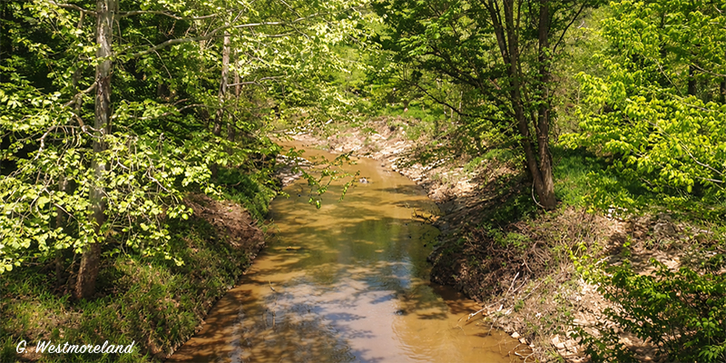
Brandywine Creek in Jefferson and Claiborne Counties in Mississippi, is one of those quietly important waterways that never makes postcards but shows up everywhere once you know to look for it—on old deeds, cemetery names, road crossings, and in family stories.
Brandywine Creek is a small, perennial stream in the northeastern part of Jefferson County, flowing through rolling hills and hardwood bottoms typical of the county’s interior. Like most creeks in this part of Mississippi, it has a meandering course, wooded banks with oak, sweetgum, and pine, and a slow to moderate flow, swelling noticeably after heavy rains. Hydrologically, Brandywine Creek is part of the Bayou Pierre watershed, meaning its waters ultimately drain into Bayou Pierre, then the Mississippi River.
About a mile east of Hwy 552 near McBride (GPS: 31.762157, -90.756807) Pierce Branch and Foster Creek come together to form Brandywine Creek. The creek flow northward gathering up branches and smaller creeks for about two miles when it crosses into Claiborne County (GPS: 31.786076, -90.758963). From there it continues northeast for about 2.5 miles where it crosses under Hwy 547. From there it takes a northerly course for a couple of miles till it empties into the Little Bayou Pierre (GPS: 31.827789, -90.736593).
![]()
![]()