
 Jefferson County, Mississippi
A Proud Part of the Mississippi GenWeb!
Contact Us:
State Coordinator: Jeff Kemp
County Coordinator: Gerry Westmoreland
Long before maps, borders, or steamboats, the Mississippi River shaped what would become Mississippi. For thousands of years, Indigenous nations—including the Choctaw, Natchez, Tunica, Chickasaw, and others—lived along its fertile floodplain, fishing its waters, farming its rich alluvial soil, trading along its banks, and building complex societies tied to the seasonal rise and fall of the river. When European explorers finally arrived in the 16th and 17th centuries—first the Spanish, then the French—they weren’t discovering empty wilderness; they were entering a thriving cultural landscape already defined by the river’s rhythms. In 1682, French explorer René-Robert Cavelier, Sieur de La Salle, claimed the entire valley for France and named it “Louisiana,” setting off centuries of colonial rivalry and shifting control along the riverfront.
After the United States acquired the region through the 1798 Mississippi Territory and Mississippi gained statehood in 1817, the river became the young state’s economic engine. Its muddy bottomlands proved ideal for cotton, and planters rushed to establish plantations along the western edge of the state. Steamboats soon dominated the river, carrying cotton, timber, livestock, mail, goods, and people between river towns like Natchez, Vicksburg, Greenville, and the booming port of New Orleans. Those steamboats turned the river into a floating highway—sometimes profitable, sometimes dangerous—and helped knit Mississippi into national and global markets. River cities grew wealthy, cosmopolitan, and politically influential, even as enslaved laborers powered that prosperity. The Mississippi River made fortunes, but it also magnified the moral, social, and human costs of slavery—something the state would wrestle with long after the Civil War.
Flooding has always been the river’s counterclaim on progress, and nowhere has that tension been felt more sharply than in Mississippi. Communities built levees almost as soon as they built river towns, but the river routinely reminded them who was in charge. The Great Mississippi Flood of 1927—still one of the most destructive natural disasters in U.S. history—submerged hundreds of thousands of acres in western Mississippi, displacing entire towns and reshaping agriculture, migration patterns, federal disaster policy, and Black civil rights activism. In the decades that followed, the U.S. Army Corps of Engineers constructed a vast system of levees, spillways, revetments, and flood-control structures, turning the lower Mississippi into one of the most engineered rivers on Earth. Even today, the state remains in a perpetual balancing act between controlling the river and respecting its power.
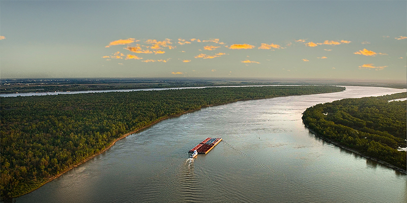
Modern Mississippi still depends heavily on the river. Its ports—especially Vicksburg, Greenville, and Natchez—handle grain, petroleum, chemicals, steel, cement, and manufactured goods, helping anchor the state’s economy. Commercial fishing, recreation, tourism, and wildlife conservation also play important roles. Culturally, the river remains Mississippi’s most enduring symbol—appearing in blues lyrics, literature, folklore, family histories, and local memory. The river is not just a border; it’s an identity. It has carried Indigenous canoes, steamboats, warships, barges, dreams, heartbreaks, and stories—often all at once.
Today, the Mississippi River continues to shape the state that shares its name. It sustains farms, connects industries, inspires artists, attracts historians, and quietly reminds everyone living nearby that nature is patient, powerful, and unbothered by human timelines. In Mississippi, the river isn’t merely scenery—it’s the original resident, the oldest road, and the storyteller whose tale never truly ends.
The Mississippi River forms the majority of the western border of Mississippi. GPS: 31.833812, -91.342922
![]()
![]()